
Itinéraires Achintee
Cliquez sur un itinéraire pour afficher ses statistiques, sa carte et son profil.
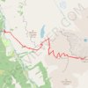
Ben Nevis by the Mountain Path
Royaume-Uni > Écosse > Highland > Glen Nevis > Achintee
GPX file from Walkhighlands; file is copyright Walkhighlands and must not be publicly shared on other websites. Do not remove this notice.
Distance : 16,1 Km • Dénivelé positif : 1 357 m • Altitude maximum : 1 337 m
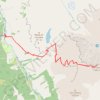
Ben Nevis by the Mountain Path
Royaume-Uni > Écosse > Highland > Glen Nevis > Achintee
GPX file from Walkhighlands; file is copyright Walkhighlands and must not be publicly shared on other websites. Do not remove this notice.
Distance : 16,1 Km • Dénivelé positif : 1 357 m • Altitude maximum : 1 337 m